
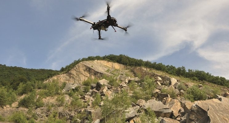
Eye in the sky
In the mining industry, the applications of unmanned aerial vehicles (UAVs), also commonly known as drones, are very varied. Ailbhe Goodbody investigates.
UAVs can add value to the mining industry in many ways, but the most common (or gateway) application is surveying. UAVs are a fast and cost-effective way of undertaking topographical surveys that reduce human intervention on-site, allow operations to continue during surveys and yield engineering-grade measurements.
“Our customers are looking to generate more data with better accuracy in a fraction of the time it would take with traditional survey methods,” says Don Weigel, vice president of professional services at Airware. “A timely and accurate serves so many other functions on the site. Giving the surveyor the ability to provide that map to his or her constituents on a regular basis can change the way geospatial data is used on a site to help improve decision-making across departments.”
UAVs can also be particularly useful for mine development and planning. Hélicéo notes that UAVs allow orthophotos to represent a 2-D plan of the whole mine, and it is also possible to create point clouds to view in 3-D the exact topography of a place.
Jason Nichols, the product marketing manager at Kespry, says: “Geologists and engineers can combine aerial intelligence data with their other geologic datasets to confidently draft geologic cross-sections to determine the seam thicknesses and structure of the formation, or perform hydrogeologic evaluations.”
Another popular application is inventory management and accounting, and this is where advanced stockpile measurement capabilities come in, whether through self-service or automated reporting. UAVs can be used to carry out stocktaking surveys at regular intervals using different sensors. Overburden, material and ore stockpiles can be automatically calculated with point-and-click mine planning tools using aerial intelligence data. Planners can quickly estimate the reserves on-site over large areas using purpose-built volumetric tools accessed from any web browser. Michael Mayer, managing director at RiCOPTER UAV, a Riegl company, explains: “The acquired data is used for the comparison and calculation of excavation and filling volumes, in so-called ‘cut and fill’ procedures especially for stockpile calculations.”
Weigel notes that there are various solutions on the market for stockpile measurement. He says: “It is easy to do ‘quick and dirty’ volumetrics, or conversely, hyper-accurate but slow volume calculations, so it is important to look at the technology that provides accurate results in a way that can be used for accounting and production scheduling. The complication comes when measuring stockpiles in a less than perfect situation such as when the stockyard is not flat, or material types are not delineated. Some solutions handle this; others do not.”
 UAV data can also be used in other departments such as safety or fleet management. For example, UAV survey results can also provide information on material displacement and work progress. Furthermore, change detection as a function of terrain monitoring can also be used as a basis for facility machine controlling, or to apply safety measures. Slope stability can be determined using surface analysis tools and 3-D visualisation tools without needing additional software. Safety berms and blocks can be monitored along with the status of or tailings dams using high-resolution images down to ½cm (per pixel ground image resolution) to ensure safety standards are aligned with the equipment on-site. Blast patterns on existing plans can be overlaid on aerial intelligence data with positional accuracies down to 2cm.
Mining companies can also accurately calculate grades of anticipated haul road routes, determine mine portal locations, and identify dump areas and staging locations using the same dataset created by designers and engineers. The performance of haul roads can be monitored and measured by assessing grade, width, super-elevation and turn-radii.
It can be much faster to fill reports from UAV data too, as they can easily be generated and shared across teams with details such as individual pile locations, material type, volume, tonnage, density and other notes.
Improved technology and reduced costs have led to operations looking at new ways they can utilise UAVs. Nick Larson, development manager at Rigid Robotics, comments: “One of the more common examples of a newer application is persistent surveillance for operations facing security issues.”
Weigel adds: “The really big innovation we are pushing is the fusion of geospatial and telematics data to improve machine efficiency and productivity. We are seeing that the true impact of UAV technology is really exposed when companies can collect aerial data and combine it with their existing data to improve operations analysis beyond the conventional performance metrics.”
Benefits
There are benefits from using UAVs over other types of aerial surveying, such as those that use helicopters or fixed-wing plane services. Remote sensing via aircraft and satellite has brought tremendous value to the geospatial community in recent decades and it continues to do so. Michael De Lagarde, CEO of Delair, says: “However, these technologies have their limitations including high mobilisation costs even for small- or medium-sized projects, the inability to collect data in poor or cloudy weather conditions, lengthy turnaround times from data acquisition to data delivery, and constrained resolution and precision of the final data deliverables.

“The gap left in the market of geospatial data collection between the point where terrestrial methods work best and traditional aerial methods are cost-effective and efficient is filled by the UAVs. Indeed, UAVs have proven in recent years to be a valuable tool, they can carry different sensors, they can perform in adverse weather, below and on-demand for rapid turnaround of data.”
In short, UAV data collection is often faster, better and cheaper than expensive manned aircraft surveys. UAVs have a much lower operating cost than helicopters or fixed-wing aircraft. Using UAVs can result in better resolution and better accuracy in the imagery produced, which results in better mapping products. Francois Gervaix, product manager at senseFly, notes: “With a single automated flight, a drone can collect timely, georeferenced imagery that is quickly transformed into a precise 3-D copy of a site. UAVs enable surveyors to achieve survey-grade accuracy.”
UAVs have the capability to approach the surface of interest closely yet safely while at the same time offering perspectives that are impossible to attain either by conventional aerial survey or by ground-based means. Mayer says: “By bringing the sensors very close to the area of interest, UAVs contribute to enhancing measurement quality considerably, resulting in a very high point density on the ground surface and, consequently, in a high level of detail of the area of interest.”
Unlike manned aircraft, UAV data collection is lower cost and available on demand when it is needed. With UAVs, operators can fly a mission that will deliver highly accurate data on demand as frequently as the business needs. For example, the mine’s blasting team may want pre-blast and post-blast mapping products, or the production manager may want daily stockpile inventories.
“Traditional aerial surveying requires advanced scheduling and is costly, which prevents mine planners and operations staff from getting the data they need to impact the business on a daily basis,” explains Nichols. “Additionally, the ability to fly the same site with the same flight pattern each time, coupled with specific capabilities that further improve accuracy, means that true comparison over time is possible for the entire mine site.”
Ease-of-use is another big advantage, as UAVs fly automated. “Anybody who is able to control a smartphone could possibly control UAV flights,” says a spokesperson from Aibotix. “Most of the planning part will be done in the office and the same for the data processing and analytics part of the mission. The flight can be operated by semi-skilled employees.”
This flexibility of UAVs should help to boost acceptance within the mining industry. A UAV weighs only kilogrammes – planes and helicopters much more and have to be operated by professional pilots. Meanwhile, UAVs guarantee operator safety because the operator stays safely on the ground while the equipment is in the air, and operating your own aerial system also means more reactivity, faster turnaround and lower cost.
In addition, the use of UAVs generally faces much lower regulatory hurdles than manned aircraft. Larson adds: “Most UAVs are also able to loiter much more efficiently than helicopters or fixed-wing aircraft and perform functions that require an extended presence over one location.”
However, UAVs will not completely replace the role of fixed-wing aircraft or helicopters in the mining industry. Larson says: “Most of the demand we are seeing for UAVs isn’t for applications that are currently performed by aircraft of any kind. In many cases, these are new solutions to problems that mine operators previously haven’t been able to solve due to cost and other barriers. In other cases, problems such as surveillance and monitoring may currently be addressed by an amalgamation of cameras, sensors and/or personnel.”
Factors to consider
The potential applications for UAVs in mining are incredibly diverse and varied. Due to this, most reasonably sized mine operations will benefit from an aerial intelligence platform. Gervaix comments: “UAVs are suitable for all applications where near real-time decisions, based on a wide overview, are needed – not just the volume and the nature of a stockpile, or the distance from a crest to some trees. For example, vehicle fleet tracking in relation to current road network requires up-to-date 3-D mapping of the pit. What is the width of this corridor? Is the size of the embankment sufficient? These are the kind of questions that can be answered.”
Nichols adds: “The most suitable project types are linked to higher volumes of material being excavated, stored and processed on , such as coal, gold, iron ore and other aggregates projects.”
However, prospective buyers should know that UAVs aren’t a one-size-fits-all solution and the requirements of the operation will greatly limit their choices for an off-the-shelf solution. As a result, there are several factors that should be taken into account before choosing UAV surveying for a site.

Before choosing a UAV for a project, the first step is to define the scope of it. Then, it is very important to be sure that the whole system is reliable, from the vector to the sensor, without forgetting the mission planning software. Weigel suggests: “You have to work backwards, starting with looking at your project goals: what analytics you need to deliver to your constituents, how frequently you are going to deliver information, and how you are going to conduct the operation. Then you need to consider what equipment and training you need to collect the data and be safe and efficient. Many people start by asking which drone to buy, but you’ve got to start by looking at the outcome you are trying to deliver.”
“The three main factors that limit the effectiveness of UAVs are typically operating duration, required payload and environmental conditions,” says Larson. “Range might seem like it is missing from that list; however, it is a matter of regulation and not UAV capability itself – in many jurisdictions such as the US, operations are still limited to line-of-sight.”
In terms of duration, many UAVs simply lack the battery power or other fuel reserves necessary for extended applications. Larson explains: “The benefits of UAV use may be negated by the amount of time required for landing and recharging/refuelling the UAVs or swapping out the batteries.”
The payload on a UAV is the sensors and/or cameras required to collect the data needed by the operator. In some cases, UAVs are sold equipped with and other sensors for a variety of applications, while others simply provide a platform to be outfitted with whatever payload the end user requires. “Those shopping for a custom UAV solution need to look ahead to what capabilities they want and consider whether the UAV will be able to accommodate the systems they need,” recommends Larson. “Heavier payloads will reduce the UAVs endurance. Because of many such trade-offs among application requirement, payload performance, UAV weight and endurance, domain knowledge in both mining and UAV is needed and it is what we see lacking from current UAV operators and mining clients.”
Generally, in topographic mapping, the larger the project area, the bigger the tool and/or the more manpower and time required to collect the data. De Lagarde says: “Smaller project areas, such as those that range from perhaps one hectare to several hectares, are likely best completed with terrestrial surveying tools such as kinematic (RTK) GNSS equipment or total stations. For projects as much as 1km2, multirotor drones are great tools which can produce very high-resolution data.
“However, multirotor UAVs are generally limited in endurance and airspeed, which reduces the amount of area they can cover per flight. It would take multiple flights, battery swaps and logistics to complete a 1km2 aerial survey with a multirotor UAV. Manned aircraft can collect relatively high-resolution data, but the economies of scale do not really justify their use unless a project is rather large, perhaps starting around 20km2.
“Therein lies the gap that professional and expert fixed-wing drones fill as an efficient and cost-effective solution for topographic mapping – projects that require high-resolution data and measure from around 1-20km2. Professional fixed-wing drones as Delair’s provide a cost-effective way to produce accurate topographic maps with small contour intervals for the most precise project requirements of surveyors and engineers.”
Environmental conditions such as wind can also reduce the effectiveness of UAV-based solutions. Many UAVs, especially the smaller ones, are not designed to fly in strong winds, and even if they can they may not be stable enough for the application it serves. Larson advises: “Altitude is less of a factor. Although given that the air is thinner at higher elevations, UAVs will not be able to perform to their stated specifications at significantly higher altitudes.”
Larson says: “This is all not to say that choosing a UAV for a mining application is only about the technical capability of the UAV. The supplier’s domain knowledge in mining is far more important and will determine whether the project is successful or not. The right supplier will provide the client with guidance to shape the selection, implementation and customisation of the UAV.”
Gervaix also recommends that ease of use is an important factor that should be considered when choosing UAV surveying for a site because, in most cases, the UAV will be operated by non-specialists who will handle it sporadically. He explains: “This means that the ground control station software must be user-friendly and make the flight easily repeatable.”
Recent case studies
Mining Magazine spoke to some of the providers of UAV equipment and services about recent projects in the mineral exploration or mining industry that they have been involved with
Aibotix
Aibotix, which is part of Hexagon’s Geosystems division, provides the Aibot X6 hexacopter solution for many industry sectors, including mining. For example, it mapped the remote Porgera gold mine in Papua New Guinea, which is situated at the head of the Porgera Valley in highlands at an altitude of 2,200-2,700m. The captured data was needed for environmental monitoring of the dump sites generated by the mine, so accuracy was of the utmost importance.

Benchmark Survey & Design, an Australian company that specialises in topographic site surveying, was contracted to map spill grounds around the secluded mine. The company enlisted a UAV pilot from Spatial Technologies, another Australian firm with more than 20 years in geographic information systems (GIS).
They faced several challenges, such as steep and unattainable terrain only accessible by helicopter, use of the helicopter only available one out of the five days to map, and extreme weather with heavy fog in the mornings and continuous rainfall in the afternoon that reduced the time window to only a few hours each day to survey.
With 32 total flights at about 10 minutes each, Spatial Technologies collected 9,100 orthophotos at a 5cm ground sampling distance. While Benchmark Survey & Design only need sub-metre accuracy for the project, Spatial Technologies was actually able to supply 10-20cm accuracy with strategically placed controls in conjunction with the RTK on the Aibot X6 UAV. The entire project was processed in about 96 hours to provide visual documentation of volume changes in the spill grounds.
Combining the orthophotos from the Aibot X6 with older data and point clouds of the site created by laser-scanning technology, the engineers and environmentalists on the project were enabled to go beyond just volume calculations. Along with the many forms of data collected, they can now see visible proof of vegetation changes and conduct slope analyses.
Delair
Freeport-McMoRan operates the copper mine at Tenke Fungurume (TFM) in the Katanga Province of the Democratic Republic of Congo. TFM’s mining activities include surface mining, leaching and SX/EW operations. The site needs weekly topographical surveys in order to calculate the production capacity and create digital surface models (DSM) of the mine. Currently, these observations are made by surveyors on foot and require the mining operations to cease. They also present a danger to the surveyors and do not achieve the most accurate measurements. Additionally, at an average size of 400ha, harvesting the data from these mines is often and tedious.
“To address TFM’s needs, Delair used their DT18 mapper drone package to create 2-D and 3-D maps of the mine,” notes De Lagarde. “Then, Delair used the capacities of its Delair Analytics platform to extract the most useful pieces of information: cubature (volume) calculations, DSM and high-resolution maps. Since Delair drone and data solutions are , they allow companies like Freeport-McMoRan to easily invest, deploy, and start seeing quick results in the form of deliverables from these next-generation aerial observation platforms.”
Hélicéo
Hélicéo and its drones have already surveyed over 500 quarries, especially in France, working in partnership with well-known companies such as Colas or Lafarge-Holcim. For quarry surveys, its most suitable equipment is the Fox6 multirotor drone which can be used in RTK or in kinematic (PPK) form.

One of Kespry’s aggregates customers, Oldcastle – APAC Central, has used Kespry data to create a series of false geologic cores to validate reserve models. Kespry offers several options for file export into third-party modelling and design software; in this case, Oldcastle – APAC Central exported the high-resolution data from Kespry directly into its geologic modelling software for stratigraphic analysis of existing conditions compared to original mine plans.
Riegl
Riegl was recently involved in an open-pit mining project in Europe. Mayer says: “The aim was to have quick access to the acquired data directly after the flight so that the geologist and mining experts could plan more detailed activities based on the light detection and ranging (LiDAR) data, including point attributes such us quality (deviation), reflectance, amplitude and multi-target capability information. Riegl used its RiCOPTER UAV platform with integrated VUX-SYS LiDAR scanning system and RGB cameras as full UAS turnkey solution.”
Rigid Robotics
Rigid Robotics’ Conductor platform is a tethered UAV, meaning that a 120m cable runs between the UAV and the ground in order to continuously provide it with power. Larson explains: “While this obviously limits Conductor’s range, it also allows for , a heavier payload and flight in worse weather conditions thanks to more power reaching the rotors.”
It is a fully customised solution that is built-to-order in partnership with mines. Larson says: “So far, we’ve seen demand for persistent surveillance as well as using LiDAR for volumetric measurement of stockpiles. We’ve also seen some more novel use cases such as using Conductor as a relay point for communications from within deep mining pits and for wildlife monitoring.”
senseFly
When Energizer Resources needed to survey its flagship graphite mine site in Madagascar, its team purchased two senseFly drones to avoid the expense of airborne LiDAR. In 2015 it contracted mining engineering company DRA to perform a full bankable feasibility study, which included a full land survey of the site.
The company looked into flying a large-scale LiDAR survey using manned aircraft, enabling it to produce a full hydrological model of the region, covering 3,000 km2. this would have been very expensive, involving the importing of aircraft from South Africa, running to hundreds of thousands of dollars. However, DRA discovered that another organisation had already flown some of the and was willing to share its data, so Energizer and DRA were able to narrow down the target region to 150km2.
Energizer chose to employ drones for the surveying due to their low price when compared to a LiDAR survey, and also because by making a capital investment in two senseFly eBee drones it could then fly these over its other properties in Canada.
The company calculated that the two UAVs would need to complete over 300 flights in total, with an average flight time of 35 minutes, an average flight coverage of 2.5 km2, and some 150 RGB images per flight (15,000 photos in total). Energizer’s three staff spent a total of 90 days in the field, setting GCPs and flying the drones. With 10-12 flights flown each day there were 16-18 gigabytes of raw data to process every night. The final data products achieved a ground sample distance of 9.75cm, and accuracy within DRA’s requested +/-20cm range.
Eric Steffler, the geomatics manager at Energizer Resources, commented afterwards: “The return on our investment has been amazing. We saved ourselves hundreds of thousands of dollars by using the drones in place of airborne LiDAR, plus we have sub-contracted our UAVs and personnel on several other jobs.”
For example, the team later flew a 44km2 mission in northern Quebec, Canada, for an exploration client. This survey was used to determine the location of remote outcrops on a large mining property.


Responses